
Lake County ZIP Coverage
The current Indiana DFR Lake County grouping supplies an official service-routing list. It is not a legal boundary database. Common postal associations below are search labels, and USPS controls the delivery label for an individual address. Several codes cross community or county-edge concepts.
| ZIP | Areas covered | Post office label | Research note |
|---|---|---|---|
| 46303, 46307, 46308 | Cedar Lake and Crown Point area | Cedar Lake / Crown Point | DFR Crown Point service group; verify 46308 by address |
| 46311, 46319, 46373, 46375 | Dyer, Griffith, Schererville area | Dyer / Griffith / Schererville | Community labels overlap the state groups |
| 46312, 46394 | East Chicago and Whiting area | East Chicago / Whiting | Check the city line at address level |
| 46320, 46323, 46324, 46327 | Hammond area | Hammond | 46323 also has Highland-area routing |
| 46321, 46322, 46325 | Munster and Highland area | Munster / Highland | DFR placement and postal city can differ |
| 46341, 46342 | St. John and Hobart area | St. John / Hobart | 46341 is in the Crown Point service group |
| 46355, 46356 | Leroy and Lowell | Leroy / Lowell | 46355 is the documented county-edge caution |
| 46376, 46377 | Schneider and Shelby | Schneider / Shelby | Verify rural delivery points individually |
| 46401-46404, 46406-46409 | Gary area | Gary | Standard Gary grouping |
| 46405 | Lake Station / Gary area | Lake Station | DFR places it with Hobart service |
| 46410, 46411 | Merrillville / Hobart area | Merrillville | 46410 also appears in Hobart service context |
The complete DFR set has 33 entries. Grouped rows make the geography readable without hiding any listed number. An older USPS table also placed 46310, 46365, 46368, and 46390 in broader regional groups, though they are absent from the current DFR Lake service list. That mismatch is why “complete” must be tied to a named source and date.
Compare Lake County ZIP Sources
Three official sources answer three different questions. The DFR list routes state service work. The Lake County postal-boundary map supplies county spatial context. USPS location and address tools confirm a delivery point. None should be silently substituted for the others.
| State DFR list | Which ZIP codes the state places in its Lake County office-routing group |
|---|---|
| County GIS map | Informational postal areas drawn with a no-warranty, non-survey disclaimer |
| USPS check | The postal city and ZIP assigned to a particular delivery address |
| Assessor and GIS | The parcel situs, municipality, postal code, and tax-mailing fields |
A useful ZIP code directory keeps a citation beside each conclusion. “Listed by DFR” is not the same as “inside Lake County.” “Shown in a postal polygon” is not the same as “inside city limits.” A USPS preferred city is a mailing convention, not a parcel jurisdiction.
Note: Date every downloaded list or map because a new service grouping or delivery assignment can change an older conclusion.
Find Lake County Residents by ZIP
No county portal inspected during research offered a single, public ZIP-only roster of residents. Use a ZIP to normalize geography, then move to an address, parcel, or name in the proper custodian. This avoids turning thousands of delivery points into an unsupported household list.
- Check the number against the current DFR grouping and record that source’s service label.
- Open the county postal map to see where the mapped postal area sits relative to nearby communities.
- Verify a known delivery point with USPS, preserving its full returned city, state, ZIP, and ZIP+4.
- Search the Assessor by the full street address, since its advanced screen has no dedicated ZIP field.
- Compare GIS Postal Code, parcel situs ZIP, municipality, and tax mailing ZIP. Flag conflicts instead of forcing one label.
When the goal becomes a named road or parcel, the Lake County street directory provides the address-level chain. Indiana Voters is a self-check portal requiring exact personal fields and county. It must not be treated as a ZIP browse tool.
Read the Lake County Service List
The state table groups ZIP codes under offices for benefit-service routing. Its Lake County grouping is a reliable transcription source for that specific task, but it does not claim to settle municipal or county boundaries. Codes associated with Hammond, Gary, East Chicago, Hobart, and Crown Point appear in service clusters that may differ from a postal-city grouping.
View the Indiana DFR office and ZIP list before using the saved capture.
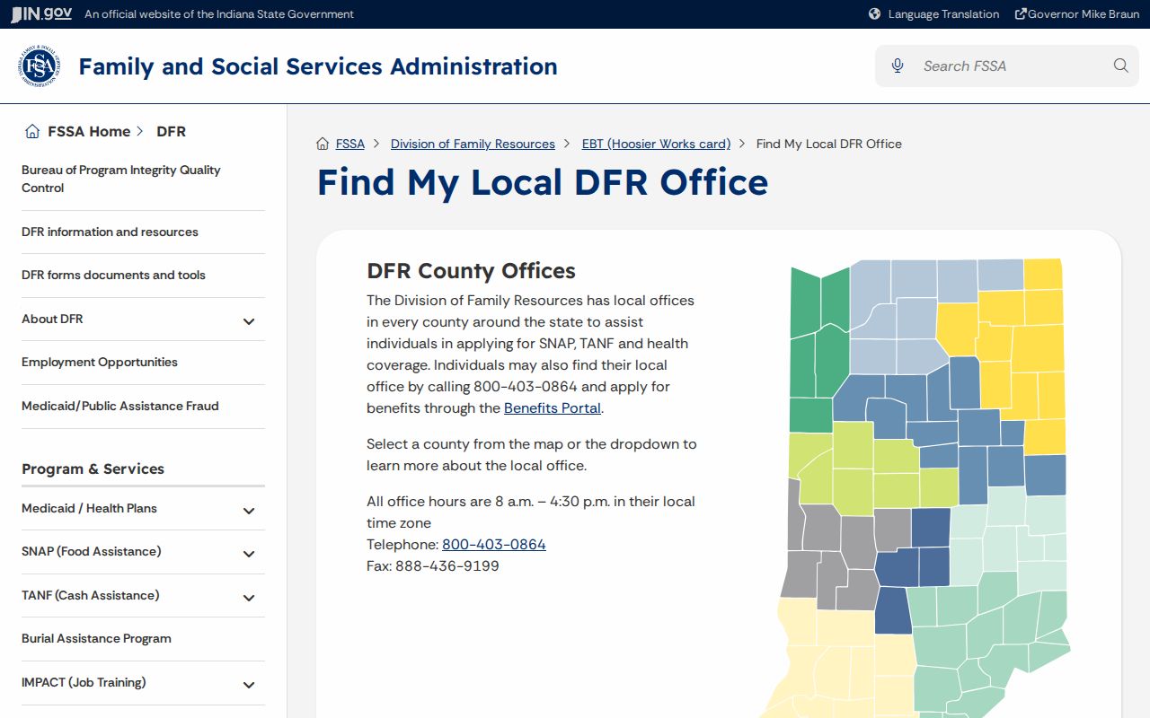
The source is strongest when its role stays explicit: it tells a user which state service grouping includes the ZIP, not the legal location of every delivery point.
The 46355 Leroy case makes the limit clear. DFR includes the code in the Crown Point group, while the USPS page labels Leroy. That is evidence of routing and postal naming, not proof that all of 46355 belongs inside Lake County.
Lake County ZIP Search Fields
County property tools rely more on address and parcel identifiers than on a stand-alone ZIP filter. The GIS service exposes Postal Code in its address-point data. It also stores situs and mailing components on parcel records. The Treasurer advertises mailing-address and location searches, while XSoft’s home box accepts an address string.
| Official portal | ZIP-related field | What was observed |
|---|---|---|
| Lake County Assessor | Address text | No dedicated advanced ZIP box observed |
| GIS address points | Postal Code | Stored with postal community, unit, PIN, and full address |
| GIS parcels | Situs ZIP and mailing ZIP | Two fields may describe different places |
| Treasurer tax search | Mailing or location text | No separately advertised ZIP-only control |
| PLA Search & Verify | ZIP | True filter for professional licenses, not residents |
| INBiz advanced search | ZIP Code | Entity and business field, not household data |
A ZIP match in a license or business record confirms only the address field carried by that record. It does not show a full household and may be a business mailing address. For property, begin with situs when the question concerns physical location and preserve mailing ZIP as a separate fact.
Verify a Lake County Delivery Point
USPS examples show why a full address beats a broad ZIP assumption. The official pages identify Crown Point at 46307, Lake Station at 46405, Lowell at 46356, Shelby at 46377, and Leroy at 46355. Their ZIP+4 endings apply to the displayed facilities, not every address in those five-digit areas.
Open the USPS Crown Point location to see how an official postal record presents a precise site.
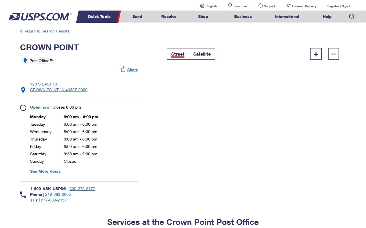
The capture links a street address to a postal city and ZIP+4. It should be used to confirm a delivery label, then checked against the county parcel and municipality fields for local jurisdiction.
Nearby-post-office links can cross community lines. That is normal for a delivery network. Do not infer that the nearest station controls the parcel, tax district, school district, precinct, or municipal record custodian.
Lake County ZIP Edge Cases
Lake Station’s 46405 is in the DFR Hobart grouping even though USPS presents Lake Station as the postal city for its Central Avenue location. Merrillville’s 46410 and 46411 also sit in a Hobart service context. Codes 46322 and 46323 can carry Highland or Hammond associations depending on the source and address. These are not errors to erase. They describe different systems.
Rural and edge codes demand the same care. The state group includes Schneider 46376 and Shelby 46377. Crown Point service routing also includes St. John-area 46341 and Leroy 46355. Before attaching a county, township, or town label, check the parcel municipality and county map as well as USPS.
Boundary check. Write “DFR service grouping,” “USPS postal city,” “GIS postal area,” or “parcel municipality” beside every label so the source remains clear.
The county postal map itself carries an informational-only disclaimer and is not an engineering or surveying product. Where the map and a parcel record seem to disagree, the appropriate county or municipal office must settle the jurisdictional question.
Define Lake County ZIP Terms
Postal vocabulary is easy to overread. A five-digit code sorts mail into a delivery network. Added digits and route data make delivery more exact, but they do not create new local-government boundaries.
- ZIP code
- A five-digit USPS routing code associated with delivery areas and postal facilities.
- ZIP+4
- The five-digit code plus four digits that narrow delivery to a segment, building, box group, or other unit.
- PO-box ZIP
- A code or portion of a code used for post-office-box delivery rather than ordinary street delivery.
- Unique ZIP
- A code assigned to one high-volume organization or institution. No Lake County example was confirmed in the research.
- Carrier route
- A USPS delivery path within a ZIP. It is operational postal geography, not a neighborhood border.
No confirmed PO-box-only or unique Lake County code appeared in the source set. The ZIP code directory should state that gap rather than labeling one from assumption. USPS address lookup is the right final check for a specific destination.
ZIP Boundaries and Lake County Limits
ZIP codes do not nest neatly inside Lake County cities. A postal city can extend past municipal lines, and an incorporated address can use a nearby community’s mailing label. Townships, school districts, precincts, sanitary districts, water districts, and tax sets form still more layers. XSoft’s long district labels make those overlaps visible.
Historical sources add time. A printed directory may preserve an earlier community name or address from before annexation or postal change. Copy the original label and publication year first. Translate it to a modern parcel only after comparing a plat, legal description, map, or dated address source.
A ZIP is also weak identity evidence. Many people and parcels share one code, while a tax mailing ZIP may belong to an owner or representative elsewhere. Use the postal number to narrow geography, then confirm the exact person or property through the record that actually owns that fact.
For privacy, retain only the minimum result needed. Indiana’s Address Confidentiality Program can replace a qualifying participant’s mailing address. Assessor restrictions may hide covered-person fields. Never combine parcel and postal clues to defeat those protections or expose someone’s location.