
Walk a Lake County Street
Begin with the complete physical address, including any direction, suffix, and unit. Lake County keeps ownership, parcel geography, tax billing, recorded instruments, and election geography in different systems. No one result is a household roll. A sound street directory search moves from broad parcel data toward narrower evidence, recording the date and exact field used at each stop.
- Enter the address in the Lake County Assessor portal. Save the state parcel number, owner field, situs, class, and data date.
- Open it in the Lake County Parcel Viewer. Compare shape, address point, municipality, and nearby parcels.
- Check the Treasurer search by location or full property number. Keep mailing and location fields separate.
- Carry the deeded owner, parcel number, and legal description into the Recorder search. Registration is required.
- For a past household, consult a dated criss-cross or city directory. Preserve its year and page before linking it to a modern parcel.
The chain reads: address to parcel, parcel to deeded owner, owner to instrument, and dated directory entry to possible occupant. Indiana Voters lets a person check their own registration. It is not a browseable roll of everyone on a road. County precinct maps can place an address in election geography without revealing a ballot or proving residence.
Search Lake County Property Fields
The XSoft advanced search gives the Lake County street directory its strongest public start. Its home box accepts an owner, address, or property number. The advanced screen adds physical and administrative filters. The live data carried an August 24, 2026 current-as-of date during research, but the county states no historical start year.
| Search field | Control | Street use |
|---|---|---|
| Owner, address, property number | Search box | Find the first parcel |
| Sale price and date | Ranges | Separate transfers |
| Assessed value | Ranges | Compare tax snapshots |
| Style, class, neighborhood, district | Lists | Narrow mixed parcels |
| Year built, area, acreage | Ranges | Distinguish similar sites |
| Basement, stories, plan | Lists | Check building traits |
District labels may combine city, township, school, sanitary, or water boundaries. Crown Point Corp and Center Township, for example, are distinct layers bundled into one option. Property class describes assessed use, not the people present.
Open the official Lake County advanced search before comparing the captured interface.
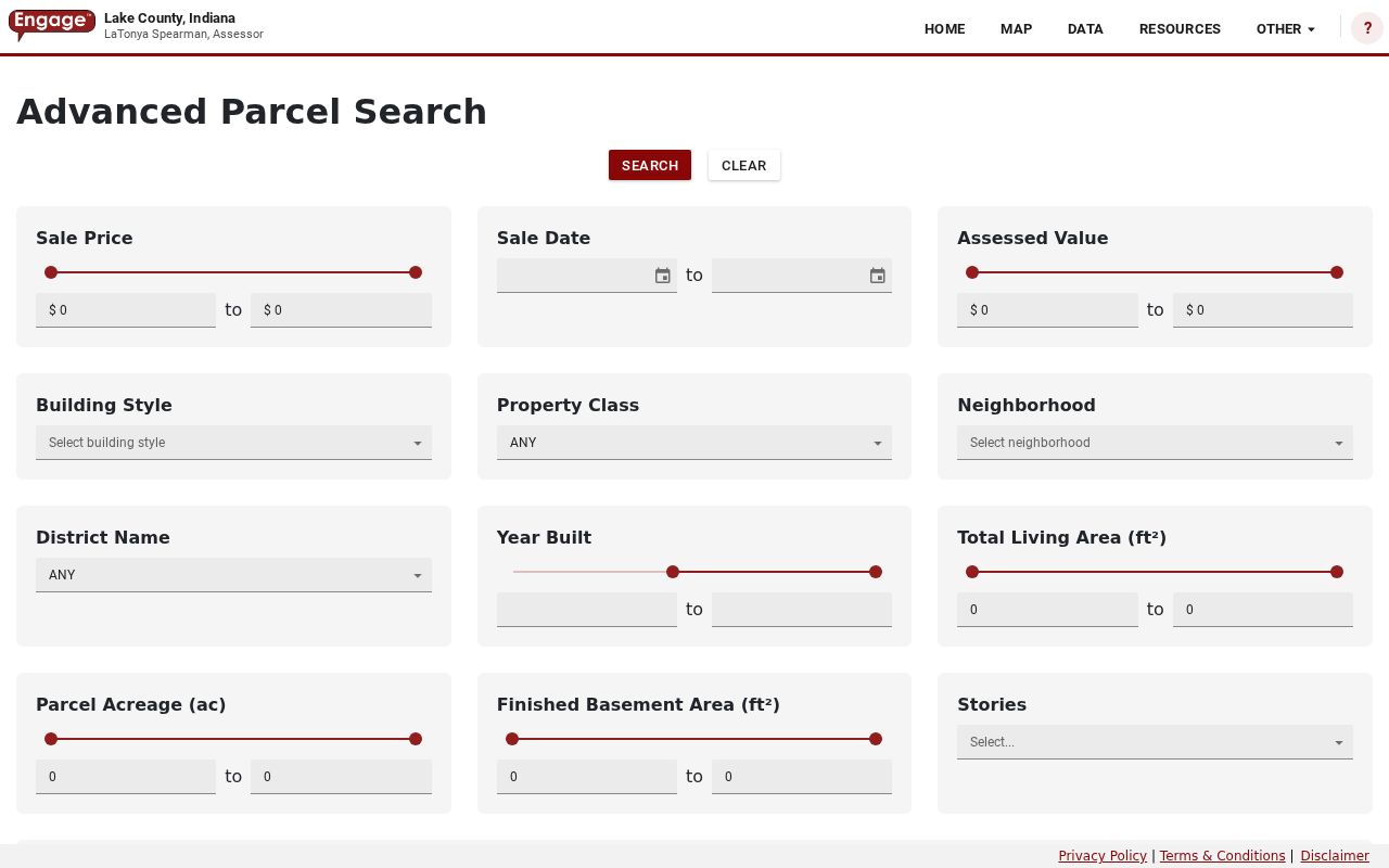
The screen supports careful filtering, but its results identify tax parcels and deeded owners rather than a complete list of residents.
Lake County Records by Address
Each official source has a narrow role. The assessor describes assessment and improvements. GIS supplies geometry. The Treasurer records tax activity. The Recorder holds legal instruments. Planning offices keep permits for their territory. This street directory table keeps those roles apart.
| Record | Keeper | What it establishes | Access |
|---|---|---|---|
| Assessment card | Assessor | Owner, situs, parcel, value, class, sale fields | Free portal or office |
| Parcel and address point | GIS / Surveyor | Geometry, municipality, postal, legal, map layers | Free Hub, viewer, service |
| Tax account | Treasurer | Billing, payments, delinquency context | Free search or offices |
| Deed, mortgage, lien, plat | Recorder | Recorded ownership or debt event | Login, paid image, phone, office |
| Permit and zoning | County or city planning | Work, jurisdiction, application trail | County portal or city custodian |
| Precinct map | Elections | Election district containing the site | PDF maps or office |
The Recorder says its office holds recordings more than 200 years old, but the website gives no index start. Call 219-755-3730 or visit Building A, second floor, 2293 N Main Street, Crown Point when an old instrument is absent online. Images cost $1 per page plus a $3 administrative fee per order.
The county permit portal serves unincorporated parcels. Incorporated places direct requests to municipal departments. No county hit may simply mean a city holds the file.
Map Lake County Street Parcels
The GIS schema separates deeded owner, situs, tax mailing address, postal code, municipality, legal description, acreage, class, Section/Township/Range, tax set, deductions, and TIF fields. The address-point layer adds unit type, unit identifier, full address, postal community, and postal code. That helps at apartment sites where several units share one tax polygon.
Click a parcel, inspect nearby polygons, then enable only the needed layer. Context includes address points, precincts, municipalities, legal drains, floodplain, watershed, wetlands, TIF districts, and historical aerials from 1978, 1998, 2005, 2013, 2018, and 2023. Draw, measure, print, and parcel-detail tools document the result. The map is informational, not a legal survey.
- Parcel
- A mapped tract tied to a county identification number and tax record.
- Situs address
- The physical parcel location, distinct from the destination for its tax mail.
- Plat
- A recorded map laying out lots, blocks, streets, or a subdivision.
- Criss-cross directory
- A dated directory arranged by street and number instead of only surname.
Section/Township/Range bridges a modern number to an old plat or deed description. Save it beside the parcel number when a road name or address has changed.
Separate Lake County Address Types
A mailing address is where a tax bill goes. A situs is where the land sits. Lake County GIS demonstrated this with an East Chicago sample: its Carey Adjacent Street site, Indianapolis Boulevard mailing destination, municipal owner, 46312 postal code, and Indiana Harbor addition description all referred to one parcel. None alone named an occupant.
The Treasurer gives separate mailing and location routes. Search with the site first. If it fails, reduce the text, spell out the street term, and use the full real-property number with punctuation when known. Save the display date because data changes.
Review the official Lake County tax search before using the captured screen.
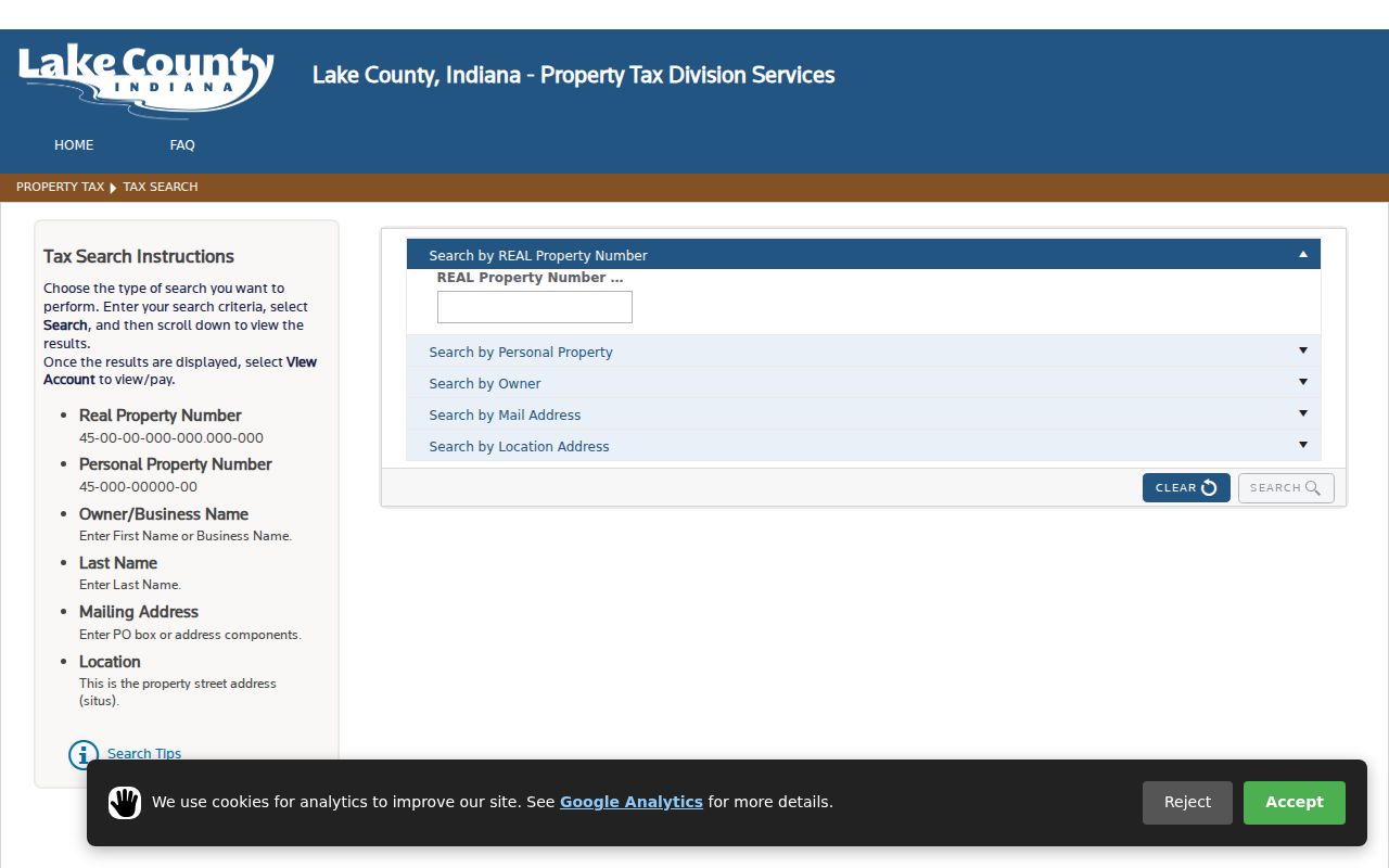
The two routes help find the correct account. Neither a payment nor tax-mail destination proves residence.
Note: Keep situs, mailing, postal community, municipality, and legal description in separate fields even when several values happen to match.
Follow Lake County Street Deeds
Once a parcel is fixed, carry its number and legal description into the Recorder. Search by parcel if supported. Otherwise use the current owner as grantee, then follow the prior grantor backward. Record instrument number, date, type, book and page or electronic reference, legal description, and image status. A grantor transfers an interest; a grantee receives it.
Type controls meaning. A deed may transfer title. A mortgage secures debt, and a release may clear it. A correction can repair wording with no owner change. A plat can redraw lots. A tax-sale notice begins a process and is not proof that redemption failed. The signed instrument, not the index line, controls.
Lake County began e-recording in March 2021. That marks intake technology, not the start of old deeds. Use the Recorder counter, phone, or registered account for copies. The Public Records Commission explains custody and retention but does not supply documents.
A good Lake County street directory research log gives each entry an evidence label. Write “assessor owner” for the tax-roll name, “deed grantee” for a person receiving a recorded interest, and “directory occupant” for a name printed at the address in a dated edition. Retain the parcel number, legal description, source date, and direct official link. These labels prevent a later reader from turning a mortgage party into an owner or a deeded owner into a current resident. If the index omits an image or old book, ask whether the instrument is available at the counter, by account purchase, or through an office copy request. The Lake County street directory is strongest when the source document remains one click or one clear office request away from the summary.
Place Lake County Streets Correctly
The precinct map collection publishes city, town, and township PDFs for Gary, Hammond, East Chicago, Crown Point, Hobart, Lake Station, Merrillville, Munster, Schererville, St. John, Whiting, Winfield Township, and other areas. Updated boundaries locate an address in election geography, not how a person voted.
Indiana Voters asks for first name, last name, birth date, and current registration county, entered exactly. It is a self-check tool. Formal computerized-data requests use the VRG-24 route and Title 3 limits. The Elections office at 2293 N Main Street, Building A, second floor, explains that channel.
Planning lines add one more layer. Lake County handles zoning, permits, complaints, variances, subdivisions, and contractor licenses for unincorporated parcels. Hammond offers its own clerk request form. Record the municipality before choosing the custodian.
Decode Old Lake County Addresses
No complete countywide renumbering schedule was found. An old number needs a method, not a guessed match. Copy it exactly with the source year. Compare the street section or criss-cross page with a plat, legal description, newspaper reference, and period map. Then connect the lot or block to a current parcel.
Sanborn maps preserve footprints, uses, blocks, and street names. The Library of Congress has nine Crown Point sheets from 1910, twelve Gary sheets from 1908, and 126 Hammond-area sheets from 1915 covering East Chicago, Indiana Harbor, and Whiting. A 103-sheet East Chicago 1930 set is cataloged but not online, so library help matters.
The Lake County Public Library Indiana Room provides directories, indexes, databases, microfilm, and research help. State Library property guidance pairs deeds, maps, directories, newspapers, and historic-structure files. Full shelf detail is in the Lake County city directories; the address workflow preserves edition, page, and order.
Limits of Lake County Street Records
A Lake County street directory cannot list every current occupant. Assessor and GIS name a deeded owner or tax contact. A deed records a legal event. A directory reflects one edition. Voter material serves elections. Renters, relatives, guests, and group residents may not appear in any open address source.
Fields may be protected. Covered-person names and addresses can be restricted under IC 36-1-8.5. Indiana's Address Confidentiality Program supplies a substitute address to qualifying participants. Federal law restricts motor-vehicle personal data. A missing name can reflect protection, timing, custody, or error.
Use address records lawfully. Never use parcel, street, precinct, tax, or directory clues to locate, stalk, harass, threaten, or expose a protected person.
Correct errors at the source: Assessor or GIS for parcel data, Recorder for instruments, Treasurer for tax accounts, Elections for voter status, and the right planning office for permits. Keep only the least detail needed, official link, and access date.