
Lake County Neighbor Block Sources
Several public layers can describe the area around one Lake County address. Each layer answers a different block question. A neighbor lookup stays accurate only when a parcel owner is not called an occupant and a planning district is not called a universal neighborhood.
| Source | What It Shows About a Block | Access |
|---|---|---|
| Lake County Parcel Viewer | Parcel polygons, address points, deeded-owner field, situs, class, municipality, nearby layers | Free interactive map |
| Assessor XSoft Engage | Owner, address, state parcel number, value, class, district, physical traits | Free online search |
| Tax account | Owner or business name, mailing address, and location or situs search | Free portal; live data |
| Election maps | Precinct code and current boundary around the address | Official PDF maps |
| City directories and Sanborn maps | Past block entries, street numbers, structures, and uses by year | Library, online catalog, or microfilm |
| Municipal planning records | Named planning district, plan area, zoning, or redevelopment context | City page, clerk request, or office |
No official countywide neighborhood-association directory was located. Community rosters may be private or member-run. Use a city clerk, planning department, library district, congregation, or an association’s own published contact rather than inventing coverage.
Map Lake County Adjacent Parcels
The official viewer supports parcel and address selection, plus point, line, polygon, rectangle, and circle drawing tools. It can measure distance or area and print a map with or without parcel details. These controls provide a repeatable way to move from one address to the lots that surround it.
- Search the full address and confirm the city or postal community before selecting a polygon.
- Open the starting parcel and record its parcel ID, situs, municipality, ZIP, class, and legal description.
- Select each touching polygon in turn. Label it “adjacent parcel,” not “neighbor.”
- Compare the Assessor or tax account through the official links, keeping situs and mailing fields apart.
- Save the map date, visible layer names, and official disclaimer with the block notes.
The flow is address to address point to parcel polygon to official property record. It does not jump from a polygon to a claim about a household. For a full search along every segment of one road, use the Lake County directory by street.
Separate Lake County Address Fields
The GIS parcel layer exposes deeded owner, parcel ID, situs street parts, mailing street parts, tax-set description, legal description, acres, property class, municipality, Section/Township/Range, and links to the Recorder, Assessor, and Treasurer. The address-point table separately lists postal community, postal code, unit type, unit identifier, PIN, and full address. That split is crucial on a block with apartments, condominiums, vacant lots, or public land.
- Situs
- The physical location field assigned to the parcel.
- Mailing address
- The destination used for tax notices or other correspondence.
- Parcel ID
- The stable county identifier used to cross-check a mapped lot.
- Legal description
- The lot, block, addition, or survey words identifying land in recorded records.
A live East Chicago sample made the issue plain: its Carey Adjacent Street situs and Indianapolis Boulevard mailing address were different, while the parcel was deeded to the city and classed as exempt municipality. That one record shows why Lake County neighbors cannot be inferred from a mailing field or an owner name alone.
Lake County Layers Shape Blocks
The Parcel Viewer offers more than lot lines. Available layers include political townships, election precincts, incorporated municipalities, floodplain, watershed, legal drains, wetlands, TIF districts, parcel labels, and historic aerials from 1978, 1998, 2005, 2013, 2018, and 2023. A drain, wetland, rail corridor, industrial tract, or municipal boundary may explain why two close parcels belong to different civic or service areas.
Those layers are context. The County Surveyor maintains government-survey corners, coordinates GIS, and oversees about 600 miles of legal drain, but the viewer is not a survey or title opinion. A line on screen does not prove a private boundary. Likewise, an Assessor district can combine a corporation, township, school, water, or sanitary label. It is not a universal name for a neighborhood.
Historic aerials can show that a road, building, or open tract changed. They contain no resident names. Pair them with dated directories, deeds, planning records, or newspaper sources when the question concerns the block’s past.
Lake County Neighbor Precinct Context
Lake County’s Board of Elections publishes individual precinct maps for cities, towns, and townships. Codes cover Crown Point, Dyer, East Chicago, Gary, Hammond, Hobart, Lake Station, Merrillville, Munster, Schererville, St. John, Whiting, Winfield Township, and other areas. Maps are updated when boundaries change. When a block crosses a line, record the map date and code.
The Lake County precinct map collection is captured below. It is useful for block geography, not for identifying voters.
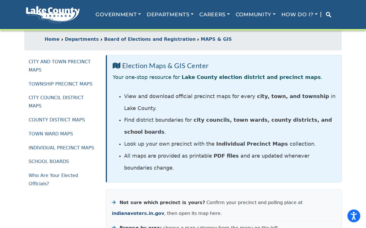
The image points to the official map route. Indiana Voters is a separate self-service tool requiring exact name, birth date, and county data. Formal voter-data requests follow Title 3 and the VRG-24 route; they must not be turned into a block list. A precinct answers where an address votes, not how a person voted.
Lake County Community Contact Routes
Lake County has no single official list of every civic group, block club, or association. Municipal and library boundaries matter. The county Planning Commission handles unincorporated land, while each incorporated city or town controls its own planning and local records. Lake County Public Library is also one district among seven independent library systems, with Crown Point, East Chicago, Gary, Hammond, Lowell, and Whiting served separately.
| Community route | Useful block context | How to ask |
|---|---|---|
| Hammond Planning and Development | Six planning districts, plus Hessville and North Hammond plans | Use the published plan or planning office |
| Hammond City Clerk | Ordinances, resolutions, minutes, and public records | View, copy, or certified-copy request |
| County Planning Commission | Permits and zoning for unincorporated parcels | Confirm jurisdiction before using the portal |
| Correct library district | Directories, local papers, yearbooks, and community histories | Ask the local-history or reference desk |
| Published association or congregation | Voluntary events, officers, or contact details | Use only its own public contact |
Hammond is a documented example, not a countywide model. Its request form offers viewing, regular copies, and certified copies, with posted fees of ten cents per page and five dollars for certification. Other municipalities may use a different route. Ask for a named plan, minute series, or record date rather than asking staff to identify private people.
Hammond Neighborhood Labels Need Dates
Hammond’s official planning material identifies six planning districts and separate plans for Hessville and North Hammond. The Hessville plan was adopted in 2001 and the North Hammond plan in 2003. These are city planning concepts. A precinct, township, postal community, sanitary district, or Assessor district can cover the same land in a different way.
The Hammond city planning source appears in the image below.
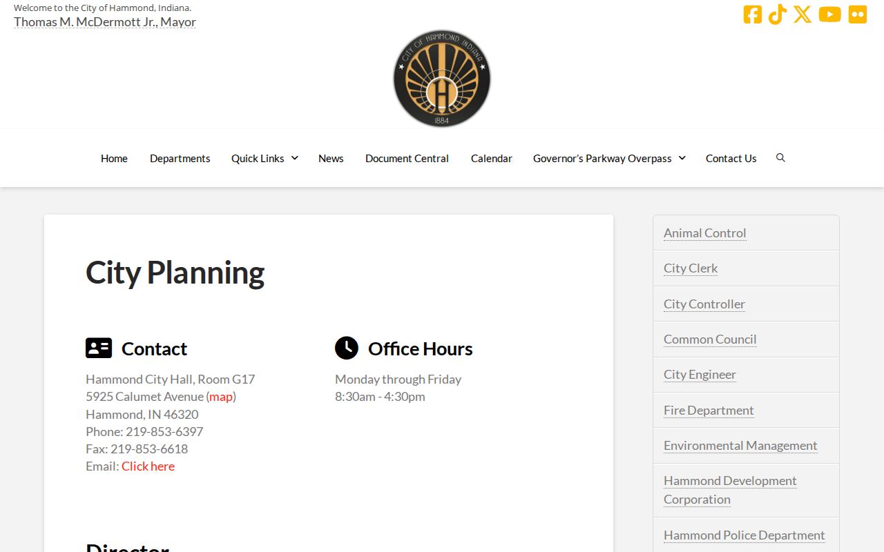
The source supports a dated planning label for a Hammond block. It does not prove membership in an association or make the label applicable to Gary, Crown Point, Hobart, or another Lake County place. Always save the plan name and adoption date with the neighborhood term.
Trace Past Lake County Neighbors
Historical blocks need sources built for their time. A city directory may place a household, business, boarder, widow, or institution at a street number in one edition. Some volumes may have reverse or criss-cross pages, but the State Library guide does not identify one complete Lake County reverse run. Inspect each edition’s front matter rather than assuming the feature exists.
Sanborn maps provide building footprints, uses, street labels, and lot context without naming people. The Library of Congress has Crown Point’s nine-sheet 1910 set, Gary’s twelve-sheet 1908 set, and Hammond’s 126-sheet 1915 set, which includes nearby industrial communities. East Chicago’s 103-sheet 1930 catalog set is marked unavailable online. That documented gap calls for a library or in-person collection, not a substitute image.
Lake County Public Library’s obituary and newspaper indexes can connect a dated name to a community. Search a surname, partial form, maiden name, city, and date, then verify the result on microfilm or a page image. An absence may reflect a missing edition, publication lag, new subdivision, changed street number, or omitted household. It does not prove the block was empty.
Official Lake County Block Evidence
Official rolls and commercial neighbor tools differ in both purpose and proof. The official source identifies its custodian, fields, date, and correction route. A commercial category may blend old addresses and names without showing which record produced the claim. For Lake County neighbors, the official block evidence is slower but easier to audit.
| Question | Official record route | Commercial category risk |
|---|---|---|
| Which parcel touches this lot? | GIS polygon and parcel ID | May reduce the block to an address list |
| Who is the deeded or tax owner? | Assessor, GIS, and Recorder | May relabel owner as resident |
| Which precinct contains the address? | Dated county election map | May omit boundary date |
| What was on the block before? | Dated directory, Sanborn sheet, deed, and newspaper | May merge years into one profile |
| How is an error fixed? | Contact the named custodian | Correction process may be unclear |
Keep a compact research note for each result: source title, access date, record type, parcel or map identifier, and direct official link. That is enough to explain the finding without republishing needless personal details.
Privacy for Lake County Neighbors
Public parcel records do not list every household member, and assessed ownership is not proof of occupancy. Utility, delivery, and private membership data are not part of the public block workflow. Indiana Court Rule 5, vital-record law, voter rules, and covered-person restrictions each close specific fields. Records may also be stale or corrected after a screenshot is made.
Indiana’s Address Confidentiality Program gives qualifying participants a substitute mailing address and protects names, addresses, phone numbers, and identifying information under its rules. Do not try to work backward from a precinct, parcel, tax field, map, or news item to reveal a protected address. Use the minimum information needed to answer a lawful question, and send errors to the source office.
Lawful use. Map Lake County neighbors for civic, family, historical, or personal context. Never use block records to watch, harass, intimidate, or harm anyone.
Note: An adjacent parcel is a spatial fact; friendship, household membership, and current presence require different evidence and consent.